VHR QA seminar
February 11, 2021 from 10:00 - 10:45 CET
Last year we hosted a live Q/A session for Danish stakeholders, and this year, due to popular demand, we will follow up with this, our very first, live Q/A session targeting a global audience.
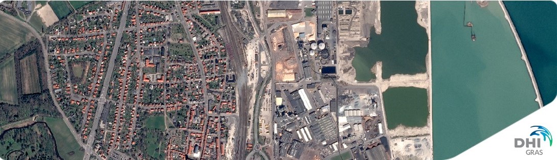
In this webinar you will get an opportunity to get answers to all your unanswered questions about Very High Resolution (VHR) satellite data. What satellites are out there in space? What can they do? When do they pass by above us? What does the data cost? – this, and much more, you will get answers to in this QA session.
So much is going on in space these years, so before we open the floor for all your questions, you will be equipped with the latest information about data types, development and application opportunities when our expert, Rasmus Borgstrøm, presents the ‘Latest news from Space’ for the first 10 minutes. Did you know, for example:
All this you will learn much more about, but if you can’t wait, you can already learn more about satellites and application potential on http://satellites.dk/.
After the introduction you will get the opportunity to ask ALL your questions when our two passionate satellite data experts, Rasmus Borgstrøm and Mikkel Lydholm Rasmussen, will be ready to answer your questions for half an hour.
Why should I participate?
The Q/A session will take place on February 11, 2021, from 10:00 – 10:45 CET. Sign up today to secure your spot at the webinar by following the registration link below.
We are looking forward to your participation!
EOatDHI part of the DHI GROUP
gras@dhigroup.com
+45 4516 9100
Agern Alle 5,
2970 Hørsholm,
Denmark
CVR: 36466871